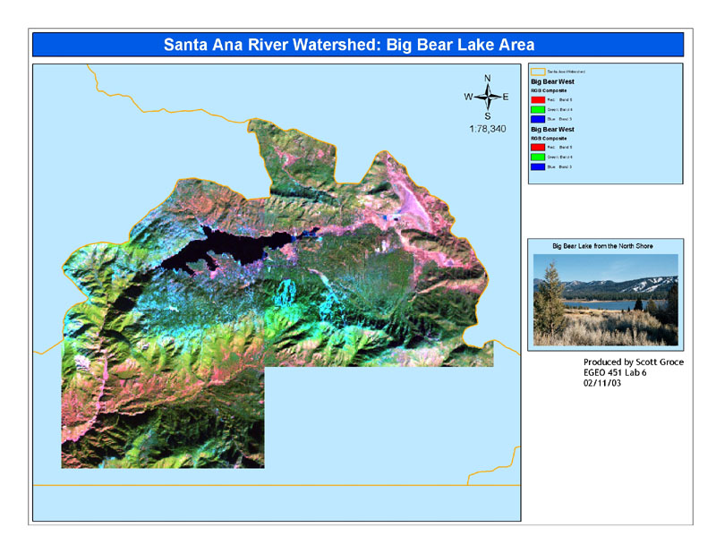
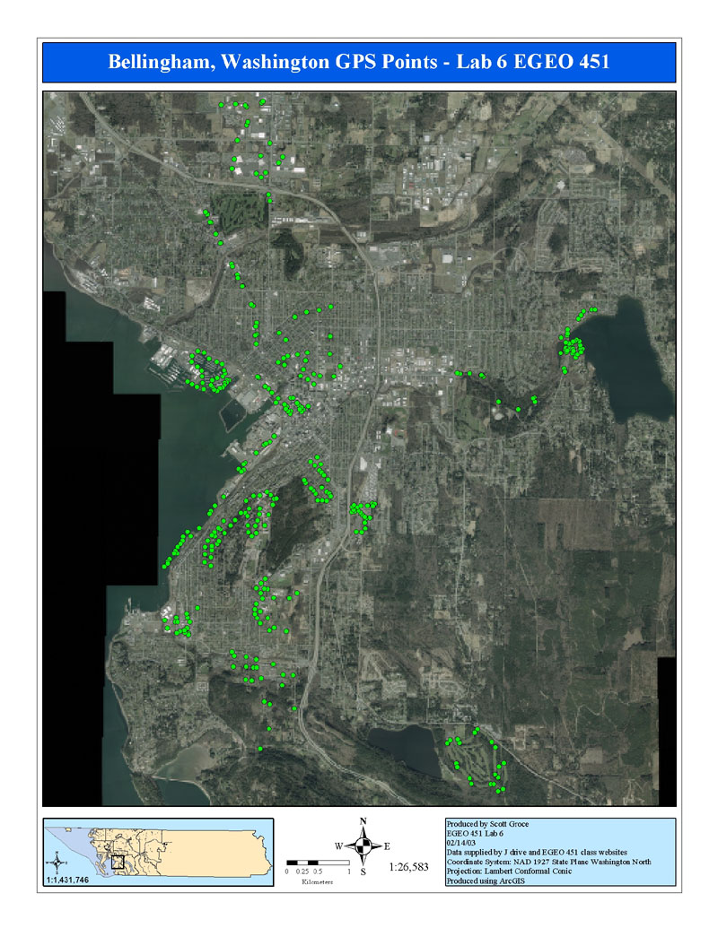
To assemble this data set and make the above map required many steps.
First, I had to download and extract from zip files all the shapefiles
produced by the separate groups in the class. Next, came the task of
adding the shapfiles to an ArcMap project. This proved to be one of the
most difficult steps because several of the shapefiles were not in the
same projection as the others. I ran all the shapefiles through the
ArcToolbox projection wizard so they were all the same projection, but
when I added all the files to ArcMap about half of them were placed
somewhere near Olympia. So I started over. I re-extracted all the
sahpefiles and again added them to ArcMap, but this time I did not change
their projections. Only one of the files was placed near Olympia this
time. To rectify that situation I deleted the .prj file associated with
that shapefile and that solved the problem. There were about 5 shapefiles
that had no projections so I assigned them the proper one and fortunately
that did not have any undesired effects. For those files that where not in
the right projection, I selected the appropriate layer in the layer
manager and right clicked on it. From there, I selected Export Data. In
the Export Data dialog I selected Export to same projection as frame and
gave the new file a name. This created a new shapefile in the proper projection. I
was then able to use the Geoprocessing Wizard to merge all the layers and
create the second map on this webpage.