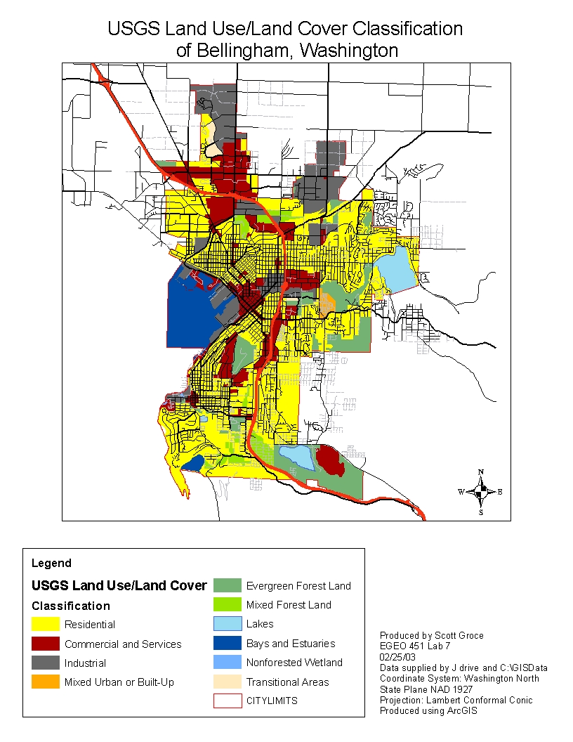
To make this map and the associated shape and layer files took many steps.
First, I added an aerial photograph of Bellingham from the class folder
on the J drive. Then I added a city limits shapefiles. Next, I added a
zoning layer, also from the J drive. I then started editing the zoning
layer and creating new polygons based on the aerial photograph. I used the
zoning layer as a reference for when I could not tell land use types apart
like when residential and commerical areas were adjacent. Once I created a
new polygon, I assigned it a USGS Land Use/Land Cover code in the attribute table and
deleted all non-essential fields and the old polygons. Finally, I added a
streets layer file from the J drive so readers could see how land use
relates to streets in the city of Bellingham.